


Here we go again
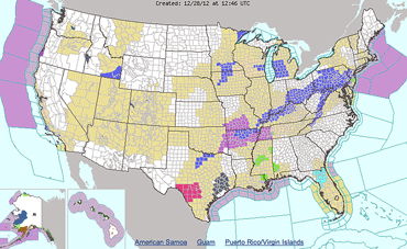
A weather system currently moving through the Mississippi Valley will track into the Ohio Valley this evening and into the upper Mid-Atlantic and Northeast on Saturday.
Widespread snowfall of 1 to 2 inches is expected, with locally heavier amounts possible, the National Weather Service said Friday.
In Highland County, new snowfall accumulations could range from 2 to 4 inches overnight Friday and into Saturday morning. Snow is expected to begging after 9 p.m. Friday.
Friday's high will be near 37, with a low around 30. East wind 3 to 6 mph. Chance of precipitation is 100 percent.
Snow showers are likely Saturday, mainly before 7 a.m., the NWS said. Saturday's low will be around 23.
Extended Forecast
Sunday – Mostly sunny, with a high near 29 and a low around 19.
Monday – Partly sunny, with a high near 36 and a low around 24. Chance of precipitation is 30%.
New Year's Day – A chance of snow. Mostly cloudy, with a high near 32 and a low of 17. Chance of precipitation is 30%.
Wednesday – Partly sunny, with a high near 30 and a low around 17.
[[In-content Ad]]