


National Weather Service confirms tornado in Sardinia
Lead Summary
By
National Weather Service-
A tornado touched down in Brown County late Wednesday morning, according to the National Weather Service.
The tornado touched down on the west side of Sardinia near Highway 24B/Maple Avenue and moved east-northeast through the village, ending on the northeast side of town near Route 32.
The NWS reports that the tornado, which was estimated to have lasted from 11:16 to 11:19 a.m., was an EF0, meaning its wind speed would have been 65 to 75 miles per hour.
The tornado is believed to have had a path width of 100 yards, with a path length of one mile.
The beginning of the tornado track was marked by scattered broken tree branches generally three to six inches in diameter. These branches tended to fall in a narrow corridor indicating convergence along the track. This was the primary damage observed near Maple Avenue, as it entered the western portion of Sardinia up to just south of the intersection with Broad Street.
A few slightly larger branches, up to approximately eight inches in diameter, were broken as the tornado moved just south of Winchester Street. Wind speeds of approximately 60-70 miles per hour likely caused much of this damage.
The tornado appeared to strengthen and widen as it continued to move near and just south of Sardinia-Mowrystown Road in Sardinia. Minor structural damage became more evident in this area, and larger trees were broken. A gas station pump was dislodged from its base near the intersection with Winchester Street, and a section of roofing approximately 45 feet by 10 feet was partially removed from a storage barn 100 yards to the east-northeast.
Tree limbs four to seven inches in diameter were broken across the street in the cemetery and fell south toward the center line of the track. Three large trees approximately 12-18 inches in diameter were uprooted and oriented toward the northeast on the south side of Sardinia-Mowrystown Road, near the intersection with Kelly Street. Wind speeds of 65-75 miles per hour likely brought down these trees, though wet soils also contributed.
[[In-content Ad]]
A brick chimney was also partially destroyed on a nearby house. An overall convergent debris pattern was evident in this area, especially with the tree damage.
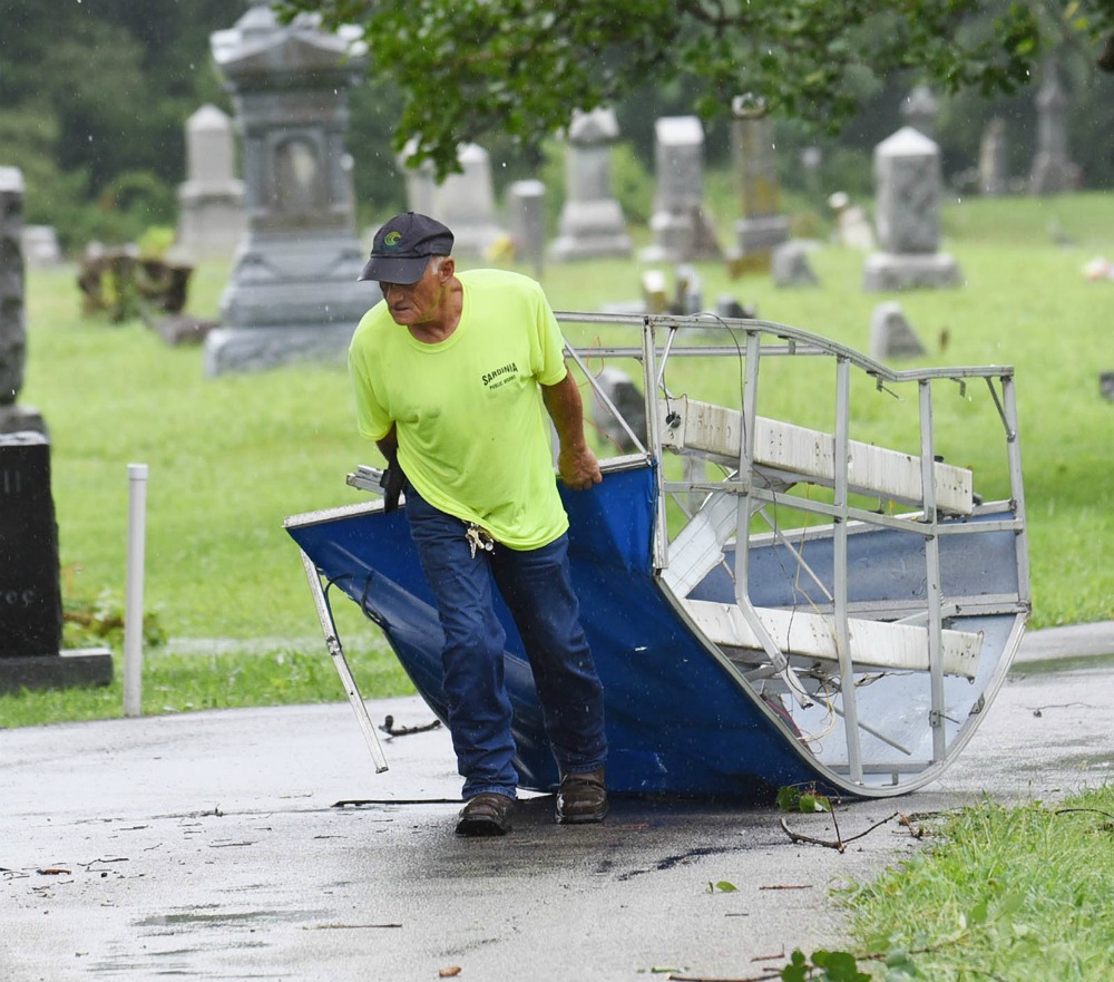
The tornado then started to weaken just before dissipating east of Brookfield Place near Highway 32 /Appalachian Highway. A metal carport approximately 20 feet by 12 feet was lifted from the north side of Brookfield Place near the intersection with Meadow View, carried across Brookfield Place and dropped on the south side of the road.
Leaf spatter was also observed on the west-facing side of a motor home near where the carport was dropped. An eyewitness at this location described a column of rotating debris associated with the tornado.
Minor tree damage was noted at the east end of Brookfield Place, after which the tornado dissipated. Wind speeds in this area were likely 60-70 mph.
No injuries were reported as a result of this tornado.
The National Weather Service extends thanks to Brown County Emergency Management and the affected homeowners for their assistance and eyewitness accounts during this survey.
The tornado touched down on the west side of Sardinia near Highway 24B/Maple Avenue and moved east-northeast through the village, ending on the northeast side of town near Route 32.
The NWS reports that the tornado, which was estimated to have lasted from 11:16 to 11:19 a.m., was an EF0, meaning its wind speed would have been 65 to 75 miles per hour.
The tornado is believed to have had a path width of 100 yards, with a path length of one mile.
The beginning of the tornado track was marked by scattered broken tree branches generally three to six inches in diameter. These branches tended to fall in a narrow corridor indicating convergence along the track. This was the primary damage observed near Maple Avenue, as it entered the western portion of Sardinia up to just south of the intersection with Broad Street.
A few slightly larger branches, up to approximately eight inches in diameter, were broken as the tornado moved just south of Winchester Street. Wind speeds of approximately 60-70 miles per hour likely caused much of this damage.
The tornado appeared to strengthen and widen as it continued to move near and just south of Sardinia-Mowrystown Road in Sardinia. Minor structural damage became more evident in this area, and larger trees were broken. A gas station pump was dislodged from its base near the intersection with Winchester Street, and a section of roofing approximately 45 feet by 10 feet was partially removed from a storage barn 100 yards to the east-northeast.
Tree limbs four to seven inches in diameter were broken across the street in the cemetery and fell south toward the center line of the track. Three large trees approximately 12-18 inches in diameter were uprooted and oriented toward the northeast on the south side of Sardinia-Mowrystown Road, near the intersection with Kelly Street. Wind speeds of 65-75 miles per hour likely brought down these trees, though wet soils also contributed.
[[In-content Ad]]
A brick chimney was also partially destroyed on a nearby house. An overall convergent debris pattern was evident in this area, especially with the tree damage.
The tornado then started to weaken just before dissipating east of Brookfield Place near Highway 32 /Appalachian Highway. A metal carport approximately 20 feet by 12 feet was lifted from the north side of Brookfield Place near the intersection with Meadow View, carried across Brookfield Place and dropped on the south side of the road.
Leaf spatter was also observed on the west-facing side of a motor home near where the carport was dropped. An eyewitness at this location described a column of rotating debris associated with the tornado.
Minor tree damage was noted at the east end of Brookfield Place, after which the tornado dissipated. Wind speeds in this area were likely 60-70 mph.
No injuries were reported as a result of this tornado.
The National Weather Service extends thanks to Brown County Emergency Management and the affected homeowners for their assistance and eyewitness accounts during this survey.