


Here we go again
The Highland County Press
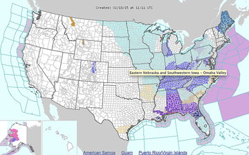
After a record snowfall Monday, followed by a record cold temperature of -5 on Tuesday, today's forecast includes both a Wind-Chill Advisory and Winter Weather Advisory.
Many area schools have already canceled classes again for Feb. 18.
Today's forecast calls for up to two inches of new snow, followed by bitter cold temperatures tonight, Thursday and Friday.
With another round of snow on its way, crews from the Ohio Department of Transportation – District 9 highway maintenance facilities are reporting for snow and ice operations.
Based on the area’s forecast and timing maps, snowplow operators in Adams, Brown, Highland, Jackson, Lawrence, Pike, Ross and Scioto counties began operations at 4 a.m. today. Depending on the arrival of the storm system and the rate of precipitation, roadways during the morning commute may be slick and icy.
As always, ODOT urges motorists to exercise additional caution and to be prepared for changing conditions. Drivers should reduce their speed, allow additional travel and stopping time, and maintain a safe following distance behind other vehicles. They should also pay special attention when traveling over bridges and overpasses, which have colder surface temperatures and are likely to freeze more quickly.
For statewide road condition information, visit ODOT on the web at www.Ohgo.com, and for winter-weather vehicle safety tips and more, visit the Ohio Committee for Severe Weather Awareness web site at http://www.weathersafety.ohio.gov/WinterVehicleSafetTips.aspx
[[In-content Ad]]
Forecast
Today – Snow, mainly before 3pm. High near 14. Wind chill values as low as -5. Chance of precipitation is 100%. Total daytime snow accumulation of 1 to 3 inches possible.
Tonight – A slight chance of snow showers. Mostly cloudy, with a low around -7. Wind chill values as low as -22. West wind 9 to 11 mph. Chance of precipitation is 20%.
Thursday – A slight chance of snow showers after 8am. Partly sunny and cold, with a high near 4. Wind chill values as low as -25. Chance of precipitation is 20%.
Thursday Night – Partly cloudy, with a low around -11. Wind chill values as low as -22. West wind 5 to 9 mph.
Friday – Partly sunny, with a high near 13. Light and variable wind becoming south 5 to 7 mph in the afternoon.
Friday Night – A chance of snow, mainly after midnight. Cloudy, with a low around 11. Chance of precipitation is 30%. Little or no snow accumulation expected.
Saturday – A chance of snow before 1pm, then a chance of rain and snow. Cloudy, with a high near 36. Chance of precipitation is 50%.
Saturday Night – Rain and snow likely. Mostly cloudy, with a low around 27. Chance of precipitation is 60%.
Sunday – A chance of snow. Mostly cloudy, with a high near 29. Chance of precipitation is 40%.
Sunday Night – Mostly cloudy, with a low around 10.