


Wind chill warning in effect
The Highland County Press
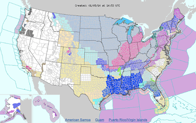
The National Weather Service has issued a wind chill warning for southern Ohio and northern Kentucky. All schools in Highland County are closed Monday due to the bitter cold.
"The storm will usher in the coldest weather in 20 years" for the region, the NWS said.
A wind chill warning means the combination of very cold air and strong winds will cause dangerously low wind chill values. This can result in frostbite and hypothermia if precautions aren't taken.
A winter weather advisory means that periods of snow can cause travel difficulties, with snow-covered roads and limited visibility.
The Monday morning low will be around 2 degrees.
Monday's forecast calls for widespread blowing snow and a slight chance of snow showers before 11 a.m. Monday will be cloudy and cold, with a temperature falling to around -6 by 5 p.m. The wind chill values could be as low as -35.
[[In-content Ad]]
Extended forecast
Monday Night – Areas of blowing snow. Cloudy, with a low around -11. Wind chill values as low as -37. Breezy, with a west wind 17 to 21 mph.
Tuesday – Areas of blowing snow between 11 a.m. and 2 p.m. Partly sunny and cold, with a high near 7.
Tuesday Night – Mostly cloudy, with a low around 4.
Wednesday – Mostly cloudy, with a high near 26.
Wednesday Night – A chance of snow. Cloudy, with a low around 25. Chance of precipitation is 50%.
Thursday – A chance of snow. Cloudy, with a high near 34. Chance of precipitation is 50%.
Friday – A chance of rain. Mostly cloudy, with a high near 39 and a low around 38. Chance of precipitation is 30%.
Saturday – A chance of rain. Mostly cloudy, with a high near 45. Chance of precipitation is 30%.