


Winter weather advisory in effect Friday
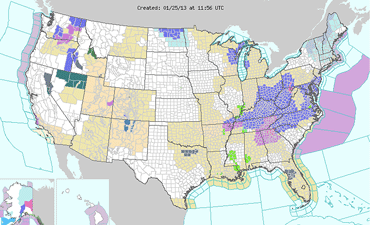
The National Weather Service has issued a winter weather advisory for Highland and neighboring counties until 5 p.m. Friday, Jan. 25.
Snow is expected to be by early afternoon with accumulations of 1 to 3 inches possible.
The chance of precipitin today is 100 percent, the National Weather Service said.
Numerous schools in northern Kentucky closed Friday in advance of the storm.
Friday's high will be near 28 with a low around 17.
[[In-content Ad]]
Extended forecast
Saturday – Partly sunny, with a high near 28. West wind around 8 mph.
Saturday night – Partly cloudy, with a low around 15. North wind around 5 mph becoming light and variable after midnight.
Sunday – Partly sunny, with a high near 34. Southeast wind 5 to 7 mph.
Sunday night – A chance of freezing rain and sleet before midnight, then a chance of freezing rain between midnight and 4 a.m., then a chance of rain after 4 a.m. Cloudy, with a low around 30. Chance of precipitation is 50%. New precipitation amounts between a tenth and quarter of an inch possible.
Monday – A chance of showers. Cloudy, with a high near 45. Chance of precipitation is 50%.
Monday night – A chance of showers. Cloudy, with a low around 42. Chance of precipitation is 40%.
Tuesday – rain likely. Mostly cloudy, with a high near 57. Chance of precipitation is 60%.